
Neenah Previous Resident Sources
No source spans every era or proves every occupant. The City of Neenah property inquiry gives the present municipal parcel context. Winnebago County land records supply the recorded transfer trail. Local directories and census schedules then help distinguish ownership from a household's presence. Newspapers, obituaries, permits, and maps can explain a move, death, remodel, split parcel, or changed street identity.
| Source | Documented span | Where to use it | Best evidence |
|---|---|---|---|
| Recorded land instruments | Most records to 1850; indexes to 1935 | Winnebago Register of Deeds terminals, Tapestry, or Laredo | Grantor, grantee, legal description, document date and number |
| Neenah/Menasha directories | Selected years from 1900 through current | Neenah Public Library Dresser History Room and selected digital scans | Address-linked household or business listings, depending on edition |
| Federal census | Public schedules through 1950 | Library genealogy databases and archival sources | Household members at an enumeration date |
| Sanborn maps | Local sets identified from 1884 to 1913 | Library of Congress and Wisconsin Historical Society | Building footprint, use, materials, and street context |
| Newspapers and obituaries | Local microfilm from 1856; obituary index 1872 to 1970 | Neenah Public Library and Winnefox obituary index | Moves, family links, probate notices, and life events |
For a recent transfer, start with the city parcel page and its sale or document-number field. For a twentieth-century household, use the parcel only to fix the site, then move to the nearest available directory and census year. Older work often depends on a legal description, deed book, map sheet, and newspaper rather than a modern street number. Each match should carry a title, year, page or record key, and access date.
Neenah Previous Resident Parcels
A street number is useful, but the parcel key and legal description are stronger. Search the City of Neenah Property Records first for a city parcel. Record the situs address, tax key, mailing address, legal description, assessment effective date, and any sale document number. Situs means the physical site. A mailing address is merely where correspondence goes, and it may be a post office box.
Then compare the result with the Winnebago County Parcel Viewer. It accepts a PIN, owner, address, certified survey map, subdivision, or municipality. Its profile links can expose parcel lineage, tax, zoning, and municipal detail. If the city and county pages conflict on current ownership, the county itself directs users back to the municipal source for a Neenah parcel. Neither system is certified title.
Note: Preserve the source's exact address spelling before trying abbreviations, direction changes, or a street name without its suffix.
Trace Neenah Previous Resident Deeds
The Winnebago County land-record search offers several access channels. Occasional users can use Tapestry. Regular professional users have Laredo. Public terminals at the Register of Deeds office provide an in-person route, and staff recommend appointments for extensive historical work. The office reports that most land records reach back to 1850 and indexes to 1935, but web images, online indexes, and terminal coverage are not identical.
- Copy the present owner's name, PIN, and legal description from the dated municipal parcel record.
- Find that owner's purchase instrument by party name, legal description, or the sale document number.
- Record the seller, who is usually the grantor, plus the recording date, instrument type, and document or book-page key.
- Search that seller as an earlier grantee to locate the prior purchase. Repeat without skipping links.
- When online coverage stops or an index fails, use the office terminal, tract index, deed book, or staff-assisted route.
- Grantor and grantee
- The grantor transfers an interest; the grantee receives it.
- Chain of title
- The linked sequence of recorded transfers for the same land.
- Legal description
- The land's formal lot, block, subdivision, CSM, or survey identity, which can survive a changed street address.
The county FAQ recommends both a quick party-name search and an advanced legal-description search because indexes can omit or misread a name. Tapestry charges $8.75 per search, $1 per image page, plus the stated online sales tax. Older pale or blue ink may scan poorly, so an image that is hard to read calls for the in-office copy route rather than a guess.
The Register of Deeds search FAQ shows the online choices and their limits.
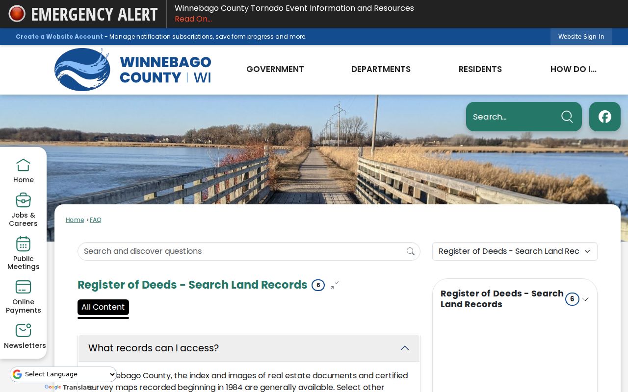
The captured county guidance is a reminder to record the search route and fee before opening images, especially when a long chain may require many pages.
Pair Neenah Directory Years
The Dresser History Room holds a long but uneven Neenah/Menasha directory run. Early confirmed editions include 1900, 1905, and 1910, followed by selected years and gaps through the twentieth century and a 2010-to-current run. A missing shelf year is not proof that previous residents had left. It means the next comparison must use another edition or record type.
- Find the address in the nearest available street index or reverse listing and save the edition and page.
- Check the prior and next available editions for first appearance, last appearance, spelling shifts, and address changes.
- Compare the household with a public census schedule from the nearest census year, while noting its exact enumeration date.
- Use a newspaper, obituary, deed, or vital index to test family links and explain moves between snapshots.
A directory listing is a publication snapshot, not proof of year-round occupancy. A census is also tied to one enumeration date. The historical collections and their publishers are treated in depth on the Neenah Directory Book page; the backward trail here uses only the editions needed for one site.
Neenah Previous Residents on Maps
A map answers a different question from a directory. The 1913 Neenah Sanborn set contains 22 digitized sheets. The Wisconsin Historical Society also has an official 1887 Neenah map record, while the local inventory identifies sets for 1884, 1891, 1895, and 1900. A Sanborn sheet can show a building footprint, use, construction detail, and nearby features. It does not name every person who lived there.
Old addresses can also drift. A directory may use a former street name, building name, rural route, or number. No official citywide crosswalk was found. Test each old address against consecutive directories, a Sanborn key map, a plat or certified survey map, municipal ordinances, and the current parcel geometry. Recent annexations near Liberty Avenue, Bayview Road, and Dixie Road show why municipality and street identity still need date checks.
Neenah Previous Resident House History
The Neenah Historical Society buildings collection shows what a source-based property narrative can look like. The Hiram Smith Octagon House dates to the 1850s. The Society describes Smith-family ownership for nearly 70 years, Vesta's widowhood through 1919, a later passage through John Brown to Quinn in 1923, and Society acquisition in 1993. Those facts are specific to that house, not a pattern to apply elsewhere.
Ward House provides a second kind of change. Built around 1912 and once used as a neighborhood polling place, it moved from Van and Adams in 2001 and now stands at 343 Smith Street as the Society's research library and offices. A search by today's address alone would miss its former site. This is a strong local reason to trace the building, parcel, and street address as separate identities.
Neenah Parcel Changes Leave Clues
Permits, plats, and certified survey maps can explain breaks in a chain. The city property record may list permit number, purpose, amount, and date. That is evidence of work at the site, not proof that the applicant or contractor lived there. A CSM, short for certified survey map, can show why one parcel became two, why a tax key changed, or why the same legal land later received a different address.
The City GIS menu includes parcel, Sanborn, aerial, zoning, future-land-use, and boundary maps. Winnebago County survey access adds plats and county-surveyor material from 1846 through 1921. When a deed's short legal description stops matching today's parcel, inspect the referenced CSM or plat and preserve the parent and child parcel numbers. Previous residents should be linked to the address only when a source states that role.
Note: A tax owner, mailing recipient, deed party, permit applicant, and occupant may all be different people or entities.
Close Neenah Household Gaps
The Winnefox obituary index covers Neenah obituaries from 1872 through 1970. It is a pointer, not the full account. Take the name and date to the newspaper image or library microfilm, then cite the newspaper, date, page, and whether the item is an obituary, notice, report, or reprint. Family statements can help identify former addresses and relatives, but they still need support from deeds, directories, or census records.
Probate notices may explain why property passed to an estate or heirs. Cemetery records can provide another date lead. Oak Hill Cemetery has city-maintained burial records, but burial there does not prove Neenah residence. When the trail reaches the missing 1890 federal census, bridge 1880 and 1900 with 1890s directories, newspapers, vital indexes, deeds, church or cemetery sources, and Sanborn maps. Label the missing decade rather than implying a complete sequence.
Separate Neenah Owners and Households
A clean chain uses role labels. Deeds can identify grantors and grantees. Assessment pages name tax owners and mailing recipients. Directories may list a householder, phone subscriber, occupation, or business. Census schedules enumerate a household on one date. None should be silently converted into “resident.” A trust, estate, corporation, or government body can own a parcel, while a renter may appear only in a directory or census.
Keep a compact source card for each finding: name as printed, role, source title, record date, access date, address as printed, record key, and confidence note. Two independent matching facts are much stronger than a shared surname. This discipline makes a previous-residents chain useful for genealogy, estate research, building history, and personal curiosity without overstating what any source proves.
Lawful use. Use Neenah house-history records for lawful personal research. Never expose a Safe at Home or confidential-elector address, or use a record to track, harass, or harm anyone.