
Sources Around Neenah Neighbors
Block research is a set of narrow questions. The parcel viewer shows lot geometry and indexed owners. The city assessment record gives a dated municipal record for each city parcel. Ward, aldermanic, polling, zoning, and assessment-neighborhood maps describe civic or administrative geography. Public minutes and planning notices can name people acting in a public role. None is a complete roster of residents.
| Official source | Block-level value | How to access it |
|---|---|---|
| Winnebago County Parcel Viewer | Parcel shapes, owner field, address, PIN, legal description, and profile links | Free web viewer with a Continue screen |
| Neenah Property Records | City parcel owner, situs, mailing, neighborhood, sale, permit, and assessment fields | Free municipal parcel inquiry |
| City interactive maps | Aldermanic, polling, parcel, zoning, aerial, boundary, and Sanborn layers | Free map menu and downloads |
| Wisconsin voter data | Lawful public ward and address context, subject to protected fields | Self-lookup through MyVote or a paid Badger Voters request |
| Minutes and planning files | Public speakers, appointees, applicants, notice areas, and organizations | City pages or a focused records request |
An owner may be a person, trust, estate, company, or public body. A mailing recipient need not live at the situs address. Permit applicants and contractors have yet another role. Treat each field as labeled, keep the effective or access date, and do not fill apparent gaps with an assumption about who occupies the home. The record's own label controls the conclusion.
Map Neenah Neighbor Blocks
The Winnebago County Parcel Viewer accepts a PIN, owner, address, certified survey map, subdivision, or municipality. The research found no documented one-click buffer or automatic neighbor list. Build the block carefully by locating one parcel, clicking only the lots that visibly touch or face it, and saving each parcel key. That method keeps the radius under the researcher's control.
- Search the starting address and confirm its municipality, PIN, and legal description.
- Note the parcel on each side, parcels across the road, and rear lots only when the map clearly shows the boundary.
- Open each profile and record the indexed owner, site address, mailing address, source date, and municipal link.
- Check each city parcel in Neenah's municipal property inquiry because county tax data may not show the city's current owner.
- Keep owners and occupants separate. A matching mailing and situs address may support a link, but it is not a public household roster.
This small radius is the proper scope for Neenah neighbors. A search of an entire named road has a different purpose and belongs in the Neenah Street Directory.
The county parcel layer field catalog documents the ownership, address, legal, value, use, building, and lineage fields behind the map.
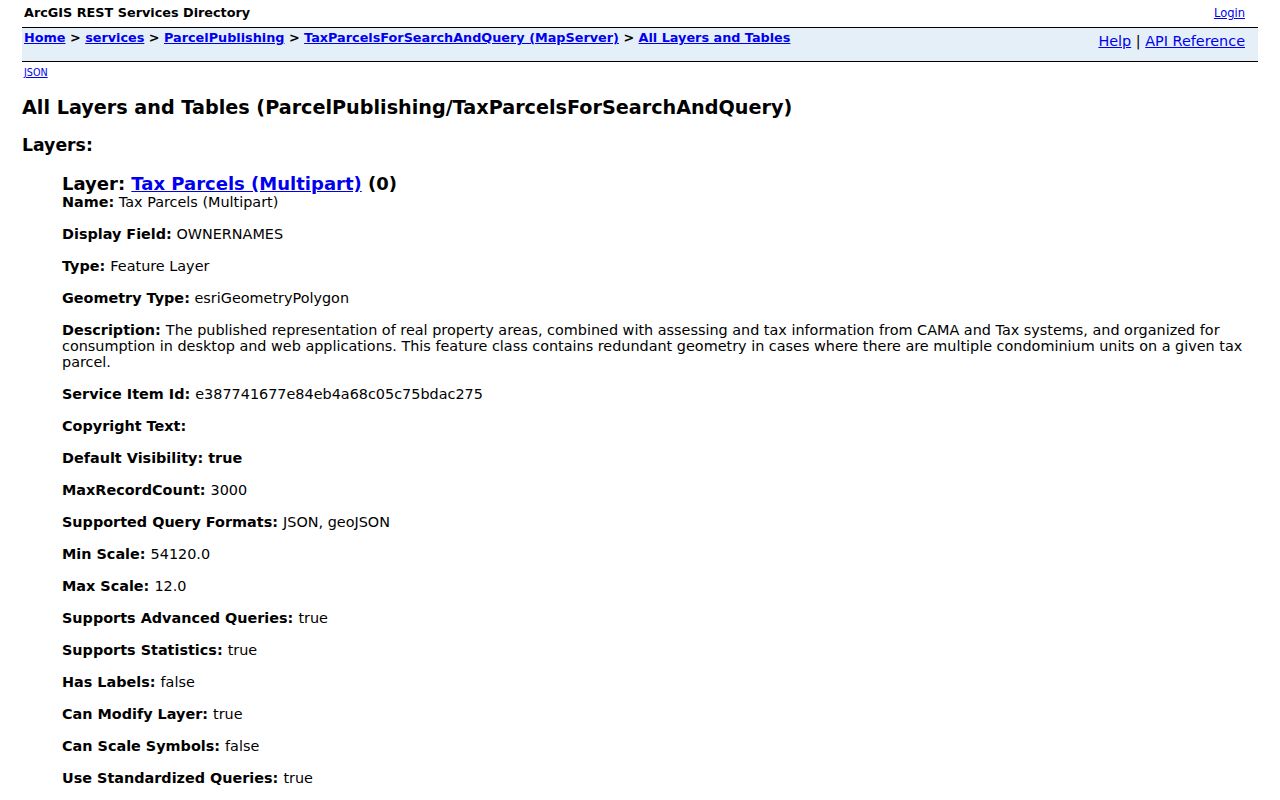
The field inventory helps identify which values came from county GIS and which still need confirmation from a municipal or recorded source.
Neenah Neighbor Labels Differ
The official 2025 Neighborhood Group Map uses assessment labels such as Central Neenah, Doty Island, Residential-Waterfront, Woodside Green, and several commercial or condominium groups. These names help organize valuation work. They are not proof of a voluntary association, homeowner membership, or a shared community directory. No official citywide directory of voluntary neighborhood associations or HOAs was located.
Compare an assessment group with the City of Neenah interactive maps. That menu offers Find My Alderman, polling places, aldermanic districts, municipal wards, parcels, zoning, aerials, future land use, and boundary agreements. Each layer has a different keeper and purpose. A neighbor can share a block yet fall on the other side of a ward, planning area, or tax grouping.
The city map menu shows how these official overlays remain separate.
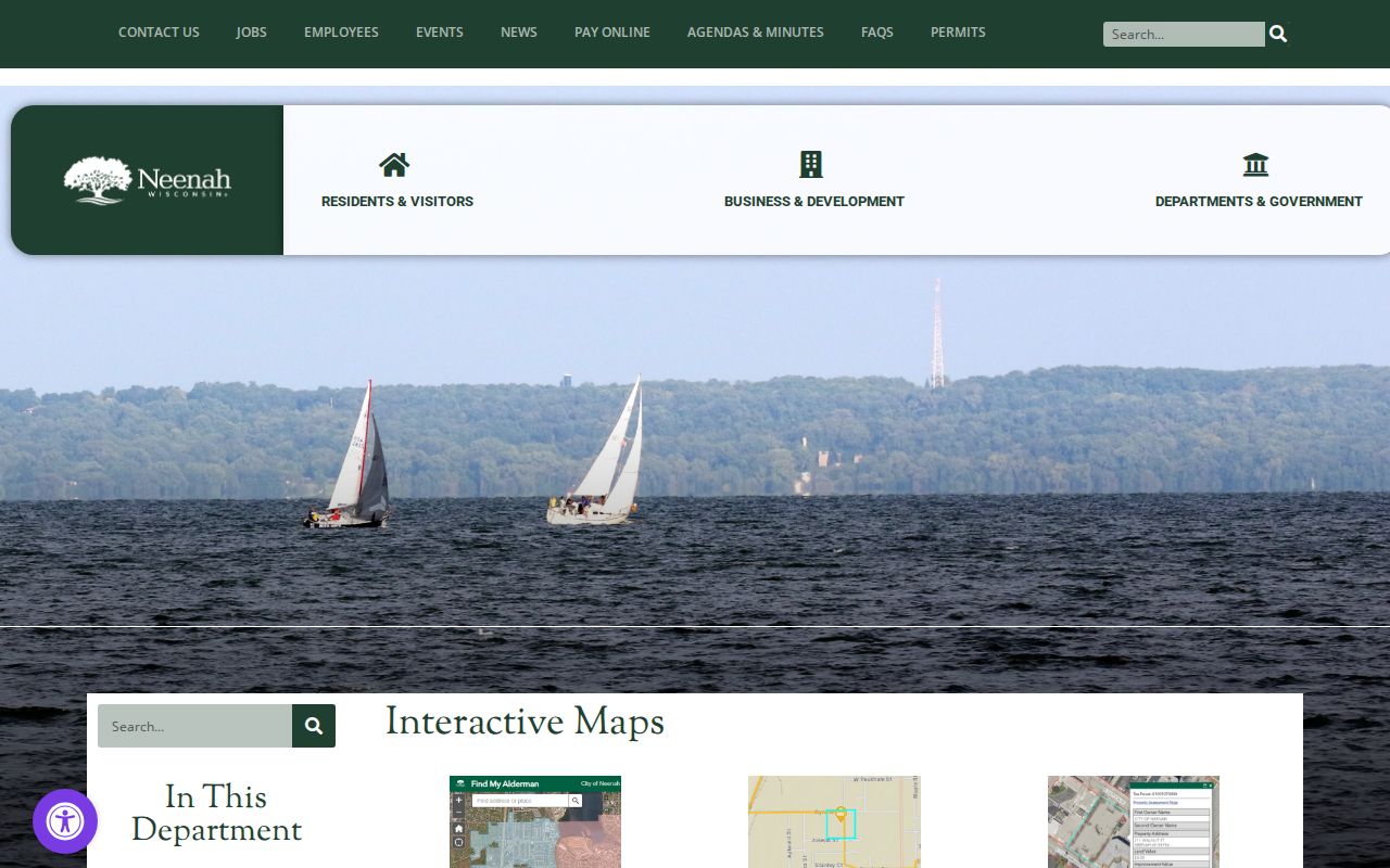
Use the layer name and map date in every note so an assessment neighborhood is never presented as a social membership list.
Neenah Neighbors in Civic Records
City Clerk records include Common Council and board minutes, ordinances, resolutions, agreements, licenses, and public-record requests. Those records can identify elected officials, appointees, speakers, petitioners, or groups that acted before the city. A meeting appearance shows a public role on a date. It does not prove residence on the block.
Planning and zoning adds another local layer. Neenah uses a 200-foot property-owner notice rule for affected zoning matters under Wis. Stat. §62.23(7)(d)(4). A notice list may reveal which owners had to receive procedural notice, but inclusion does not prove association membership or occupancy. Ask for a specific matter, address, and date range through the city open-records route. Neenah states a five-working-day response or denial target, or an explanation of when the record can be supplied.
Note: City police records use a separate request route, so send a focused block-related request to the custodian that created the record.
Wisconsin Voter Data Has Limits
MyVote Wisconsin is designed for a voter to find and confirm that person's own record. It asks for first name, last name, and date of birth, then uses a “This is Me!” confirmation. It is not a tool for testing who lives at every nearby house. A failed match calls for spelling checks or municipal-clerk help, not public speculation.
Badger Voters is the formal data-request route. It offers voter, absentee, custom, and nomination data with geographic filters such as municipality, aldermanic district, and ward. Requests cost money, and custom work adds the stated programming charge. Wisconsin does not track party affiliation, so election history must never be turned into a claim about party membership.
Wis. Stat. §6.36 governs public list fields, while §6.47 protects confidential electors. Dates of birth, identification data, accommodation information, and confidential addresses require strict handling. If a Neenah neighbor uses Safe at Home or has a protected elector record, do not map, infer, or publish the actual address.
Community Records Near Neenah Blocks
Community sources can add context without becoming a resident roll. The Neenah Historical Society maintains a research library at Ward House, exhibitions, programs, objects, and photographs. Its interactive Wisconsin Avenue map pins buildings and businesses with short histories. Future Neenah publishes downtown programs and events, but no verified public member roster was found. Event attendance or a donor mention should not be turned into proof that someone belongs to an organization.
City Clerk
Use dated agendas, minutes, appointments, licenses, and focused records requests for public civic roles.
Historical Society
Use Ward House research material and the Wisconsin Avenue map for documented block and building history.
Dresser History Room
Use directories, newspapers, census tools, and local collections to study an older block without implying current occupancy.
Public Works street-use permits and City Clerk carnival or solicitor permits may identify an organizer tied to a public event or location. Preserve the named role and date. The permit does not list all Neenah neighbors who took part.
Choose Official Neenah Block Records
Commercial neighbor tools often blend old addresses, phone data, and third-party matches without showing the source date. Official records are narrower. That limit is useful because each field has a named custodian, role, and date that can be checked.
| Approach | Useful for | Main caution |
|---|---|---|
| County and city parcel records | Parcel identity and indexed ownership | Owner is not the same as occupant |
| Civic maps and public minutes | Ward, district, notice, and public-role context | Geography or attendance is not membership |
| Commercial compiled tools | Possible leads | Unclear dates, merged identities, and weak correction paths |
For personal safety, use special-purpose official sources only for their stated purpose and heed every warning. Proximity alone does not prove risk, relationship, or conduct. Save only what the lawful task needs.
Historic Neenah Blocks Need Dates
A present parcel map can be paired with a historical map, directory, and newspaper to study how a block changed. The 1913 Library of Congress Sanborn set shows building-level geography across 22 sheets. Local directory holdings begin with confirmed 1900, 1905, and 1910 editions and continue through selected later years. Neither source should be forced to answer a modern occupancy question.
Ward House is a vivid warning about place identity. The building once served as a neighborhood polling place and moved from Van and Adams in 2001 to 343 Smith Street. A map search by the current site alone would hide its earlier context. Compare building, parcel, and street histories separately, especially when an annexation, plat, certified survey map, or move changed the visible block.
Protect Neenah Neighbors' Privacy
Public does not mean publish everything. Parcel records usually do not identify renters, children, guests, or every household member. Utility customer data, delivery details, full dates of birth, driver-license numbers, Social Security numbers, financial records, victim or witness addresses, and sealed court material do not belong in a block list. Keep the source, record type, date, and minimum useful public field.
Wisconsin Safe at Home provides assigned addresses for eligible participants. Confidential-elector safeguards also restrict disclosure. A protected or substitute address is a hard stop, not a puzzle to solve through other maps. Do not reverse-geocode it, compare it with parcel owners, or seek a workaround. Neighborhood curiosity never outweighs a person's safety.
Lawful use. Research Neenah neighbors only for lawful personal, civic, historical, or safety purposes. Never watch, intimidate, harass, expose, or harm another person.